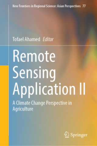
Kniha Remote Sensing Application II Tofael Ahamed

Remote Sensing Application II

A Climate Change Perspective in Agriculture

Autor: Tofael Ahamed
Jazyk: Angličtina
Vazba: Pevná
Vydavatel: Springer, Berlin
Dostupnost: Skladem u dodavatele
Odesíláme za 10-18 dnů
4 217
This book focuses solely on the issues of agricultural productivity analysis with advanced modeling...

Informace o knize

Jazyk
Angličtina
Vazba
Kniha - Pevná
Vydáno
2024
Stránek
400
EAN
9789819711871
Enbook ID
44742819
Vydavatel
Hmotnost
836
Rozměry
155 x 235

Kompletní popis

This book focuses solely on the issues of agricultural productivity analysis with advanced modeling approaches bringing solutions to food-insecure regions of the world, especially in south and southeast Asia and in Africa. Advanced modeling tools and their use in regional planning provide an outstanding opportunity to help face the challenges of climate change. The sudden effect of flash floods, drought, salinity, and sea water rises causing saltwater intrusions and its impact on agricultural production are some of the disastrous results of climate change.In this edited volume, information on climate-induced impacts for flooding, flash floods, and drought impact on agricultural crops is provided to address possible solutions for food security in south Asia, southeast Asia, and some regions of Africa. Leading-edge research methodology is presented as it relates to remote sensing applications for regional science and allied fields. In regional policy planning, agriculture and forestry play key roles in food security along with environmental conservation and depend on geo-spatial variability. Satellite remote sensing and geographical information systems have an immense potential to encompass all these factors and to catalogue the regional variability of climate change and climate economics. In the satellite remote sensing domain, advanced modeling tools, deep learning applications, and cloud-based earth engines significantly increase the flexibility of decision making and its application for regional perspectives. The result can increase agricultural and forest productivity and ensure its resilience and sustainability.The book's chapters introduce modeling techniques such as machine learning and fuzzy expert system using satellite remote sensing datasets based on cloud application. These methods assist regional planners to increase crop production, land use, and detection of changes in land cover in order to better understand their vulnerability to climate-related disaster. Furthermore, remote sensing and in-depth GIS analysis are integrated with machine learning to address natural uncertainties such as flash floods, droughts, and cyclones so that emergency responses for agricultural production management can be adopted more effectively.

Mohlo by vás zajímat

Colon Cancer

Mary L. Seagraves
410
626

Four Tests

Daniel Baer
475
244

The Future of War

Lawrence Freedman
938

Woodturning Trickery

David Springett
551

Sceptical History

Helene Bowen Raddeker
1 385
1 595

Coral Reef Science

Hajime Kayanne
2 742

Zákaznicí kteří koupili tuto knihu koupili také

342

Fitness

Susaeta
169